


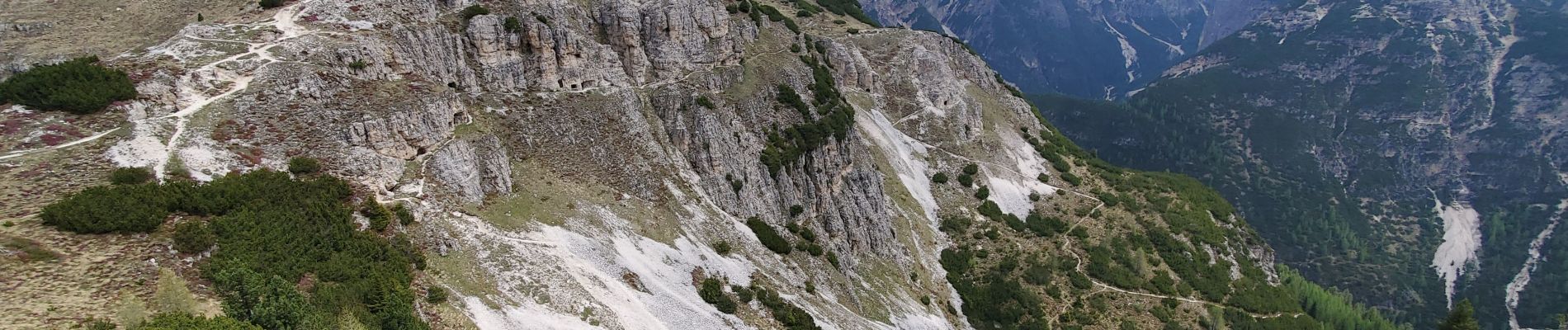
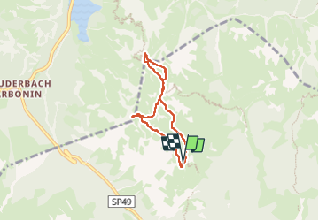
monte piana 210m 5.32km

Danielba
User GUIDE

Length
5 km

Max alt
2321 m

Uphill gradient
208 m
Km-Effort
7.8 km

Min alt
2199 m

Downhill gradient
209 m
Boucle
Yes
Creation date :
2025-06-04 07:38:39.967
Updated on :
2025-06-04 12:28:55.015
2h09
Difficulty : Very easy

FREE GPS app for hiking
 SityTrail
IGN / Geographical institutes
SityTrail Plus
The world is yours!
About
Trail Walking of 5 km to be discovered at Veneto, Belluno, Auronzo di Cadore. This trail is proposed by Danielba .
Photos


Positioning
Country:
Italy
Region :
Veneto
Department/Province :
Belluno
Municipality :
Auronzo di Cadore
Location:
Unknown
Start:(Dec)
Start:(UTM)
289497 ; 5165545 (33T) N.
Comments